How Tides Affect Inshore Fishing in Charleston
Charleston's tidal swings are the single biggest factor in inshore fishing success. Learn how to read tide stages, identify prime feeding windows, and time your trips around moving water for consistent results.
How Tides Affect Inshore Fishing in Charleston
Charleston SC fishing revolves around one master variable: the tide. These massive Lowcountry waters rise and fall with astronomical force, moving billions of gallons through our maze of creeks, rivers, and sounds twice daily. Whether you're working the grass beds of Stono River or drifting oyster bars in Charleston Harbor, understanding how tides trigger feeding windows, concentrate baitfish, and position gamefish is the difference between a slow day and a bent rod. The challenge isn't knowing that tides matter — it's reading exactly how current conditions are setting up the bite right now.
Why Charleston's Tidal Range Creates Feeding Opportunities
Charleston's 5-6 foot tidal swings — with spring tides occasionally reaching 7 feet or more — create some of the most dynamic inshore fishing on the East Coast. This massive water movement acts like a conveyor belt, carrying baitfish, flushing creeks, and oxygenating backwaters from Bulls Bay down to North Edisto. As water rushes over oyster bars and through creek mouths, it dislodges crabs, shrimp, and small fish — creating ambush points where redfish and speckled trout wait to feed.
The key insight most Charleston anglers miss is that it's not just about incoming versus outgoing tide. It's about how the tide interacts with structure, wind, and water temperature to create micro-environments where gamefish concentrate. A falling tide might pull baitfish off a grass flat in Shem Creek while simultaneously stacking them against a dropoff in the Wando River. Understanding these patterns separates consistent anglers from those who struggle.
MarshMind tracks exactly how current tidal conditions are setting up feeding opportunities across every Charleston zone — check today's bite plan.
How Moving Water Positions Gamefish
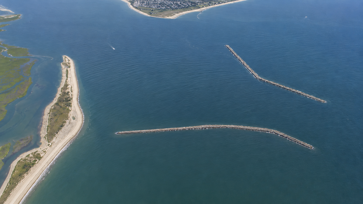
Tidal current doesn't just move water — it positions fish. Redfish use current breaks and eddies as ambush points, while speckled trout often suspend in moving water where the flow concentrates baitfish. In areas like Breach Inlet or Morris Island, swift-moving water creates current seams where gamefish patrol predictably.
The magic happens where different water masses meet. When Stono River water meets Ashley River flow in Charleston Harbor, the convergence creates feeding lanes that hold fish consistently. Similarly, where tidal creeks empty into larger bodies like Bohicket Creek or the ICW, the mixing zones become gamefish magnets.
Wind direction adds another layer of complexity. A southwest wind against an incoming tide creates completely different fishing conditions than the same wind with an outgoing flow. These interactions determine whether fish will be shallow and aggressive or deep and finicky. Smart Charleston anglers read these signs to position themselves where the action will develop.
Use MarshMind to see which current breaks and convergence zones are scoring highest for your target species today.
Creek Systems and Tidal Timing
Charleston's extensive creek network from James Island to Johns Island responds differently to tidal phases. Narrow creeks like those feeding into Folly Beach warm and cool faster than main rivers, creating temperature-driven feeding windows that align with specific tide stages. These smaller waterways also concentrate baitfish during certain tide phases, making them redfish and trout magnets when conditions align.
The challenge is that every creek system has its own personality. Some produce best on the first two hours of a tide change, others fire during mid-tide flow, and still others turn on during slack periods. Creek depth, width, and connection to main waterways all influence how fish use these areas throughout the tidal cycle.
Successful Lowcountry anglers develop a mental map of how their favorite creeks fish during different tidal phases and seasonal conditions. They know which bends hold fish during falling water, which mouths produce during incoming flow, and how wind direction changes everything. This local knowledge takes years to develop through trial and error.
MarshMind eliminates the guesswork by scoring every Charleston creek system against current conditions in real time.
Structure and Tide Interaction
Oyster bars, grass beds, and dropoffs fish completely differently depending on tidal stage and flow direction. Rising water floods shallow grass areas around Kiawah Island and Isle of Palms, creating expansive feeding flats where gamefish hunt aggressively. As water falls, these same areas concentrate fish along edges and deeper pockets.
Charleston Harbor's complex bottom structure creates hundreds of micro-environments that activate and deactivate with tide changes. A shell bar might hold fish during specific flow conditions but remain barren an hour later when water direction shifts. Rock piles and artificial structure add another variable — they create current breaks and eddies that change dramatically as water levels rise and fall.
The key is understanding how structure modifies water flow. A grass bed that's invisible during high tide might become a current-breaking highway during low water, channeling baitfish into predictable paths. Similarly, oyster bars that are exposed at low tide create current deflection patterns that position gamefish in feeding lanes when covered by rising water.
MarshMind's zone scoring system accounts for how current tide conditions are affecting structure across Charleston's waters.
Seasonal Tide Patterns and Fish Behavior
Tidal influence on Charleston inshore fishing changes dramatically with seasons. Spring tides during warming periods trigger different responses than identical tides during fall cooling trends. Water temperature, daylight length, and baitfish movements all modify how gamefish respond to tidal flow, creating complex patterns that vary from Bohicket Creek to Sullivan's Island.
During cooler months, fish often require specific combinations of tide, temperature, and weather to become active. The same tidal conditions that produce explosive action in summer might result in slow fishing when water temperatures drop. Conversely, winter patterns that seem marginal can turn incredible when all variables align properly.
Baitfish movements complicate the picture further. Shrimp migrations, mullet runs, and menhaden schools all respond to tidal flow, but their seasonal timing changes throughout the year. Understanding how these prey species use tides during different seasons helps predict where and when gamefish will feed most aggressively throughout Charleston's diverse water system.
The app updates tide scoring based on current seasonal patterns and baitfish activity — see which zones are firing today.
Use MarshMind for Real-Time Tidal Intelligence
While understanding tidal concepts gives you the foundation, Charleston's complex water system demands real-time intelligence to consistently find fish. MarshMind analyzes current tide conditions against water temperature, wind, barometric pressure, and seasonal patterns to score every fishing zone across the Lowcountry. Instead of guessing which tide phase might produce, you'll know exactly which areas are primed for action right now and how long the window will last.
[Check Today's Bite Plan on MarshMind]
 charleston
 Charleston fishing
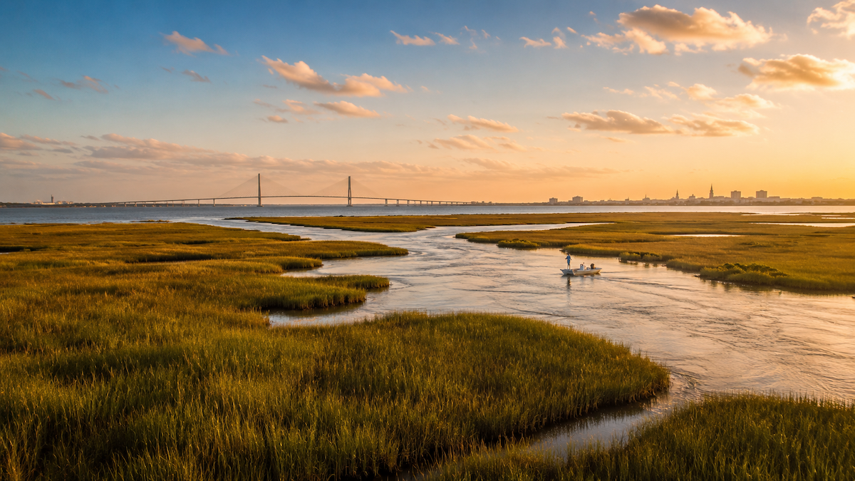 charleston fishing